
![]()
- Hazard Description, Risks, & Associated Disruptions
FLOODING
Floods are the most common U.S. natural hazard, known for the greatest number of lives lost and highest property damages/costs. Floods can occur at any time of year, in any part of the country, and at any time - day or night. While heavy precipitation is a frequent cause of flooding - hurricanes, infrastructure failures (dam/levees), winter storms and snowmelt can also cause moderate to severe flooding [10 Facts About Flooding , AmericanRivers.org].

From, "Mapping America’s wicked weather and deadly disasters," by Tim Meko, Washington Post, April 2019:
According to NOAA, floods kill an average of 90 people each year in the US., the highest average of any type of natural disaster. Most flood deaths occur as people are swept away in cars and other vehicles. The reasons vary with climate and topography.
In the middle of the country, tributaries of the Missouri and Mississippi rivers routinely overspill their banks, sometimes causing catastrophic flooding such as this spring’s deluge in Nebraska, Iowa and adjacent states. As seasonal temperatures rise, snow melts early and inundates the river system at the same time spring rains hit. The water has nowhere else to go.
In other places, intense rains can trigger flash floods in areas where the terrain funnels water into a narrow space. Ellicott City, Md., has suffered two 1,000-year floods in the past three years because it sits at the bottom of a hill where several streams converge.
Areas within a wide band of Texas, from north of Dallas to south of San Antonio, are so prone to flooding that the entire zone is referred to as “Flash Flood Alley.” Steep canyons and valleys of the desert southwest routinely channel torrents of water from storms at higher elevations.
_________________
Flash flooding hits Ellicott City, Maryland - CBS News, May 2018:
_________________
Flood Types
NOAA - National Severe Storms Laboratory (NSSL)
SEVERE WEATHER 101: Floods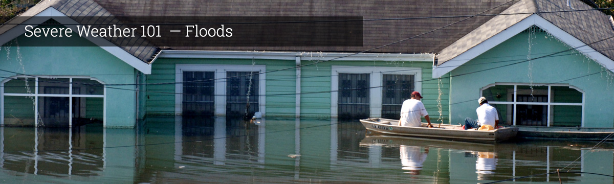
River Flooding - occurs when water levels rise over the top of river banks due to excessive rain from tropical systems making landfall, persistent thunderstorms over the same area for extended periods of time, combined rainfall and snowmelt, or an ice jam.
Coastal Flood - or, the inundation of land areas along the coast, is caused by higher than average high tide and worsened by heavy rainfall and onshore winds (i.e., wind blowing landward from the ocean). Places like Charleston, South Carolina, and Savannah, Georgia, experience impacts from shallow coastal flooding several times a year because of coastal development and lower elevation.
Storm Surge - is an abnormal rise in water level in coastal areas, over and above the regular astronomical tide, caused by forces generated from a severe storm's wind, waves, and low atmospheric pressure. Storm surge is extremely dangerous, because it is capable of flooding large coastal areas. Extreme flooding can occur in coastal areas particularly when storm surge coincides with normal high tide, resulting in storm tides reaching up to 20 feet or more in some cases. Along the coast, storm surge is often the greatest threat to life and property from a hurricane. In the past, large death tolls have resulted from the rise of the ocean associated with many of the major hurricanes that have made landfall. Hurricane Katrina (2005) is a prime example of the damage and devastation that can be caused by surge. At least 1500 persons lost their lives during Katrina and many of those deaths occurred directly, or indirectly, as a result of storm surge.
Inland Flooding - occurs when moderate precipitation accumulates over several days, intense precipitation falls over a short period, or a river overflows because of an ice or debris jam or dam or levee failure. Hurricane Floyd (1999), aided by Tropical Storm Dennis (1999), caused widespread severe flooding that caused the majority of the $3 to 6 billion in damage reported after those storms.
Flash Flood - is caused by heavy or excessive rainfall in a short period of time, generally less than six hours. Flash floods are usually characterized by raging torrents after heavy rains that rip through river beds, urban streets, or mountain canyons. They can occur within minutes or a few hours of excessive rainfall. They can also occur even if no rain has fallen, for instance after a levee or dam has failed, or after a sudden release of water by a debris or ice jam.
NOTE: Areas damaged by wildfires are particularly susceptible to flash floods and debris flows during rainstorms.

Rainfall that is normally absorbed by soil and vegetation can run off almost instantly, causing creeks and drainage areas to flood much earlier and with higher magnitude than normal. Heavy rainfall on recently burned areas can also mobilize sediments and cause a much more destructive debris flow ["Severe Weather 101," The National Severe Storms Laboratory - NSSL / NOAA].
... To learn about Wildfires, you can move onto the next Hazards section - here. Or, use the drop-down menus to learn how to mitigate & prepare for mild to moderate, and catastrophic flood events (continue below...)
- Flood MITIGATION Strategies
Mitigation ...
- Flood PREPAREDNESS
Preparing for Flood
- RECOVERY Resources
Recovery Resources - FLOOD
——————————————————
Additional Reading / Info Sources
——————————————————
⭐~Floodsite.net~⭐
We spent time thinking about it!
We tried to narrow it, to figure out what portions of this site were best to share – to highlight it – briefly, in an “additional readings” blurb / hyperlink …
Yet! We couldn’t come up with something succinct to share with you – from this somewhat mysterious website that as far as we can tell emerged (circa 2002) from The 6th EU Research Framework Programme [the site – Floodsite.net, lacks a typical “About Us” page, however, despite the lack of description of who is behind it – we have found its contents to be sound and quite valuable.]
So – It was tough deciding which path to send you down / start you on – within this incredibly FULL site detailing flood – types of flood, descriptions of dam/levee failures, flood risk evaluation, in some ways – the philosophical “weighing” of risk, in-text hyperlinks to methodologies scientists use in attempts to “calculate” risk – and, yet! the site is written in a very easy-to-understand, “gentle” manner (in our opinion)…
That said! …
We’ve decided to share this excerpt, and a few more links from Floodsite.net beneath it, and we hope you will explore it further!
From, “Risk of Floods (continued – pg.2)“
Probability and consequences determine the size of a risk. High or low probability, large or small consequences, how you determine that?
The concepts high and low, large and small are relative. The people involved in the end determine what is an acceptable risk. A risk that we can live with. The government, provinces, municipalities and water authorities (or environment agencies) together with scientists, citizens and interest groups (such as natural and environmental organizations) decide how high a risk is acceptable. The discussion takes place in all kinds of meetings, through public opinion and in newspapers and television. If the risk is found to be too high, measures must be taken to reduce the risk.
Scientists develop ways to calculate risks, on the basis of for example: water height statistics, climate figures, strength of dikes, estimates of the amount of victims and economic loss estimates.
Measures cost money, often they cost space too that will be at the expense of other functions such as nature or economic activities. So choices have to be made. What steps should you take to make the risk of flooding of this new housing project acceptable? How much does it cost? Are those costs reasonable? Do these measures mean that other houses will become more vulnerable? Would it be better to build somewhere else?
In the discussion about water safety scientists make use of various methods to investigate probability, pathways, receptors, vulnerability and costs of measures. Another tool is the use of scenarios. Yet it is not just a matter of addition and subtraction. How do you take for example the loss of life in your calculations? How exactly do you determine the chance of a [dam] breach? Do you calculate long-term injury or not? And how do you calculate the impact such measures have on the landscape?
The calculations and analysis support the discussion, but do not decide on the conclusions in the discussions. People do.
Landing Page: https://www.floodsite.net/juniorfloodsite/html/en/student/thingstoknow/geography/hazard.html